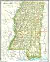
1. Sturgis, Mississippi and the surrounding area is located in Township 17 North and Range 12 East. This area is located in the most Southwestern corner of Oktibbeha County, bordered by Choctaw County in the West and Winston County to the South. In order to learn more about the Township and Range system, please see the Graphical Display of Township and Range. Each of the counties in Mississippi is split up into townships, ranges and sections using this system.
The Township 17N Range 12E has been highlighted in yellow on the map. Section one starts in the upper right hand corner and ends in section six in the upper left hand corner. The sections than zigzag South, ending in Section 36 in the far bottom right hand corner. Morgantown and Craig Springs are located to the East, as well as the Noxubee River and the Tombigbee Forest. Hwy 12 runs into Sturgis from Starkville and continues on to Ackermann in Choctaw County in the West. About 10 miles to the North lie Double Springs and Maben. To the Southeast lies Louisville in Winston County.
4. Geographic Name Information System (GNIS)- Find the location where your ancestors lived on a topographical map! The Federally recognized name of each feature described in the data base is identified, and references are made to a feature's location by State, county, and geographic coordinates. Even see "bird's eye" photos!
5. Govt Land Patents at the Bureau of Land Management - find out if your ancestors received land from the government. Records are searchable for MS by county or name of person. If your ancestor did not pay cash for the land, you can get his file from the land office and receive valuable genealogical information!
6. County Formation Maps - Still having trouble figuring out which county was formed and when? If you are a person whose family has changed counties three times without even moving, the website above is for you. Great interactive maps and worth a visit!
7. How to get maps
 a. MS Dept of Transportation Maps (showing township and range). These are the large black and white maps, mainly focused on man-made structures. You can use the county maps to plot your ancestor's land. State maps are also available and shipping is prompt and accurate! All maps are listed in inches with prices.
36 x 51 = $3 ea (w/township, range and grids annotated)
18 x 25 = $1 ea
12 x 17 = 25 cents ea
shipping and handling = $4
To get more specific information, you can call them at 601-359-7045. You can send a check or money order to: MS DOT Map Sales
b. U.S. Geological Survey Maps, which illustrate geographical features of an area including the location of structures. You can get these at stores in the sporting goods stores in the area which supply equipment to hikers, hunters or fishermen. They can also be obtained from the U.S. Geological Survey Office, Reston, VA 22092 or call +1 (800) USA-MAPS or order maps online. Just type in "Sturgis" under mapname and choose Mississippi. Also try the website Topozone, the first site to offer topographic maps of the entire US online!
c. Print maps of Sturgis from your computer, courtesy of Yahoo. Find addresses, streets and possible living relatives by doing an address search and typing in a street name from the map. When you are ready to visit Sturgis, get driving directions here too!
8. Recommended Reading:
Land and Property Research by Hone E. Wade - demystifies property and land records and shows you how to use them in your genealogical research. Try to get it first through your library's interlibrary loan.